Log in
All resources
Create a design
337 Free Images of 1865 In The Netherlands
gemeente atlas van nederland - south holland
1860s maps of south holland
gemeente atlas van nederland - north holland
1860s maps of north holland
19th-century maps of rotterdam
oil on canvas
cultural heritage agency of the netherlands art collection
paintings in the cultural heritage agency of the netherlands art collection
landscape painting
krimpenerwaard in the 19th century
gemeente atlas van nederland - south holland
maps of zuid-beijerland
gemeente atlas van nederland - south holland
19th-century maps of rotterdam
19th-century maps of south holland
netherlands in the 1860s
gemeente atlas van nederland - north holland
old maps of haarlem
gemeente atlas van nederland - south holland
19th-century maps of rotterdam
gemeente atlas van nederland - south holland
19th-century maps of rotterdam
gemeente atlas van nederland - south holland
1860s maps of south holland
paintings by bernard blommers
hague school
gemeente atlas van nederland - south holland
old maps of delft
gemeente atlas van nederland - north holland
old maps of haarlem
gemeente atlas van nederland - south holland
1860s maps of south holland
gemeente atlas van nederland - south holland
1860s maps of south holland
photographs in the rijksmuseum amsterdam
cartes de visite of the netherlands
gemeente atlas van nederland - north holland
blokker
gemeente atlas van nederland - south holland
old maps of brielle
gemeente atlas van nederland - south holland
1860s maps of south holland
gemeente atlas van nederland - south holland
maps of 's-gravenzande
gemeente atlas van nederland - south holland
1860s maps of south holland
gemeente atlas van nederland - south holland
1860s maps of south holland
gemeente atlas van nederland - south holland
19th-century maps of rotterdam
historical images of rome by edmond behles
historical images of rome
gemeente atlas van nederland - overijssel
old maps of kampen, netherlands
gemeente atlas van nederland - north holland
old maps of alkmaar
gemeente atlas van nederland - south holland
1860s maps of south holland
paintings in the dordrechts museum
hague school
gemeente atlas van nederland - south holland
1860s maps of south holland
gemeente atlas van nederland - south holland
19th-century maps of rotterdam
gemeente atlas van nederland - south holland
1860s maps of south holland
gemeente atlas van nederland - south holland
1860s maps of south holland
gemeente atlas van nederland - south holland
maps of haastrecht
gemeente atlas van nederland - south holland
maps of ameide
gemeente atlas van nederland - south holland
1860s maps of south holland
police officers of the netherlands
people of the hague
gemeente atlas van nederland - south holland
1860s maps of south holland
gemeente atlas van nederland - south holland
1860s maps of south holland
gemeente atlas van nederland - south holland
maps of hendrik-ido-ambacht
gemeente atlas van nederland - south holland
1860s maps of south holland
gemeente atlas van nederland - north holland
maps of bergen, north holland
gemeente atlas van nederland - south holland
19th-century maps of rotterdam
gemeente atlas van nederland - south holland
strevelshoek
gemeente atlas van nederland - south holland
1860s maps of south holland
gemeente atlas van nederland - south holland
1860s maps of south holland
paintings in the cultural heritage agency of the netherlands art collection
marinus adrianus koekkoek (i)
landscape paintings in the groninger museum
petrus johannes schotel
paintings in the cultural heritage agency of the netherlands art collection
paul tetar van elven
huib van hove bz
hague school
maps of nieuwpoort, south-holland
vestingwerken nieuwpoort
gemeente atlas van nederland - north holland
maps of beemster
gemeente atlas van nederland - south holland
old maps of brielle
gemeente atlas van nederland - south holland
maps of koudekerk aan den rijn
gemeente atlas van nederland - south holland
old maps of the hague
gemeente atlas van nederland - south holland
1860s maps of south holland
gemeente atlas van nederland - utrecht
jacob kuyper
gemeente atlas van nederland - north holland
19th-century maps of amsterdam
gemeente atlas van nederland - zeeland
19th-century maps of zeeland
gemeente atlas van nederland - south holland
old maps of leiden
gemeente atlas van nederland - north brabant
demen
gemeente atlas van nederland - south holland
1860s maps of south holland
gemeente atlas van nederland - south holland
old maps of gouda
gemeente atlas van nederland - south holland
old maps of eiland van dordrecht
gemeente atlas van nederland - south holland
1860s maps of south holland
gemeente atlas van nederland - south holland
1860s maps of south holland
gemeente atlas van nederland - south holland
1860s maps of south holland
gemeente atlas van nederland - south holland
1860s maps of south holland
gemeente atlas van nederland - south holland
old maps of gouda
paintings in the cultural heritage agency of the netherlands art collection
naturalism,impressionism
gemeente atlas van nederland - south holland
giessen (river south-holland)
gemeente atlas van nederland - south holland
maps of waddinxveen
maps of nieuw-helvoet
nieuw-helvoet
maps of landgraaf
rimburg
gemeente atlas van nederland - south holland
giessen (river south-holland)
gemeente atlas van nederland - south holland
1860s maps of south holland
gemeente atlas van nederland - south holland
1860s maps of south holland
gemeente atlas van nederland - south holland
maps of krimpen aan de lek
gemeente atlas van nederland - south holland
maps of zoeterwoude
gemeente atlas van nederland - south holland
maps of kedichem
gemeente atlas van nederland - south holland
1860s maps of south holland
gemeente atlas van nederland - south holland
1860s maps of south holland
gemeente atlas van nederland - north holland
maps of uithoorn
gemeente atlas van nederland - south holland
1860s maps of south holland
gemeente atlas van nederland - south holland
maps of wassenaar
gemeente atlas van nederland - south holland
1860s maps of south holland
gemeente atlas van nederland - south holland
1860s maps of south holland
gemeente atlas van nederland - north holland
maps of texel
gemeente atlas van nederland - south holland
1860s maps of south holland
gemeente atlas van nederland - south holland
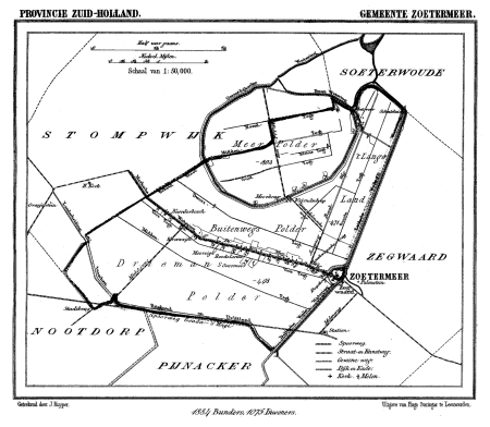
maps of zoetermeer
gemeente atlas van nederland - south holland
1860s maps of south holland
gemeente atlas van nederland - south holland
1860s maps of south holland
gemeente atlas van nederland - zeeland
bommenede
gemeente atlas van nederland - south holland
maps of groot-ammers
paintings in the cultural heritage agency of the netherlands art collection
male portrait paintings by charles howard hodges
gemeente atlas van nederland - north holland
old maps of alkmaar
gemeente atlas van nederland - south holland
1860s maps of south holland
gemeente atlas van nederland - north holland
19th-century maps of amsterdam
gemeente atlas van nederland - south holland
1860s maps of south holland
gemeente atlas van nederland - south holland
1860s maps of south holland
gemeente atlas van nederland - south holland
maps of zegwaart
kinderhuisvest, haarlem
willem johan boogaard
gemeente atlas van nederland - south holland
1860s maps of south holland
gemeente atlas van nederland - north holland
old maps of amsterdam
101 - 200 of 337
Next page
/ 4